

Bankable Wind Measurements with LiDAR Technology
Complete turnkey LiDAR campaigns — fully bankable, IEC-compliant, and hassle-free.
Our ServicesEnd-to-End Wind Measurement Solutions.

LiDAR Rental
Turnkey rental of ground-based remote sensing LiDAR devices calibrated and ready for deployment.

Installation & Setup
Complete site preparation, power supply, and secure LiDAR installation by certified engineers.

Remote Monitoring
Daily data monitoring and and early anomaly detection throughout the campaign.

Data Quality Control
Rigorous filtering, validation, and statistical analysis following IEC 61400-12 and MEASNET guidelines.

Reporting
Comprehensive installation, monthly and final measurement reports accepted by banks and consultants.

Campaign Management
End-to-end project coordination from initial prospecting through to final data delivery.
Industry-Leading LiDAR Systems

Pulsed Doppler LiDAR from Vaisala
Measurement range:
40m – 300m (max 20 heights)
Power consumption:
~45W nominal
Wins speed accuracy:
up to ±0.1 m/s
Wins speed uncertainty:
1.6% @60m, 0.8% @120m, 0.35% @200m
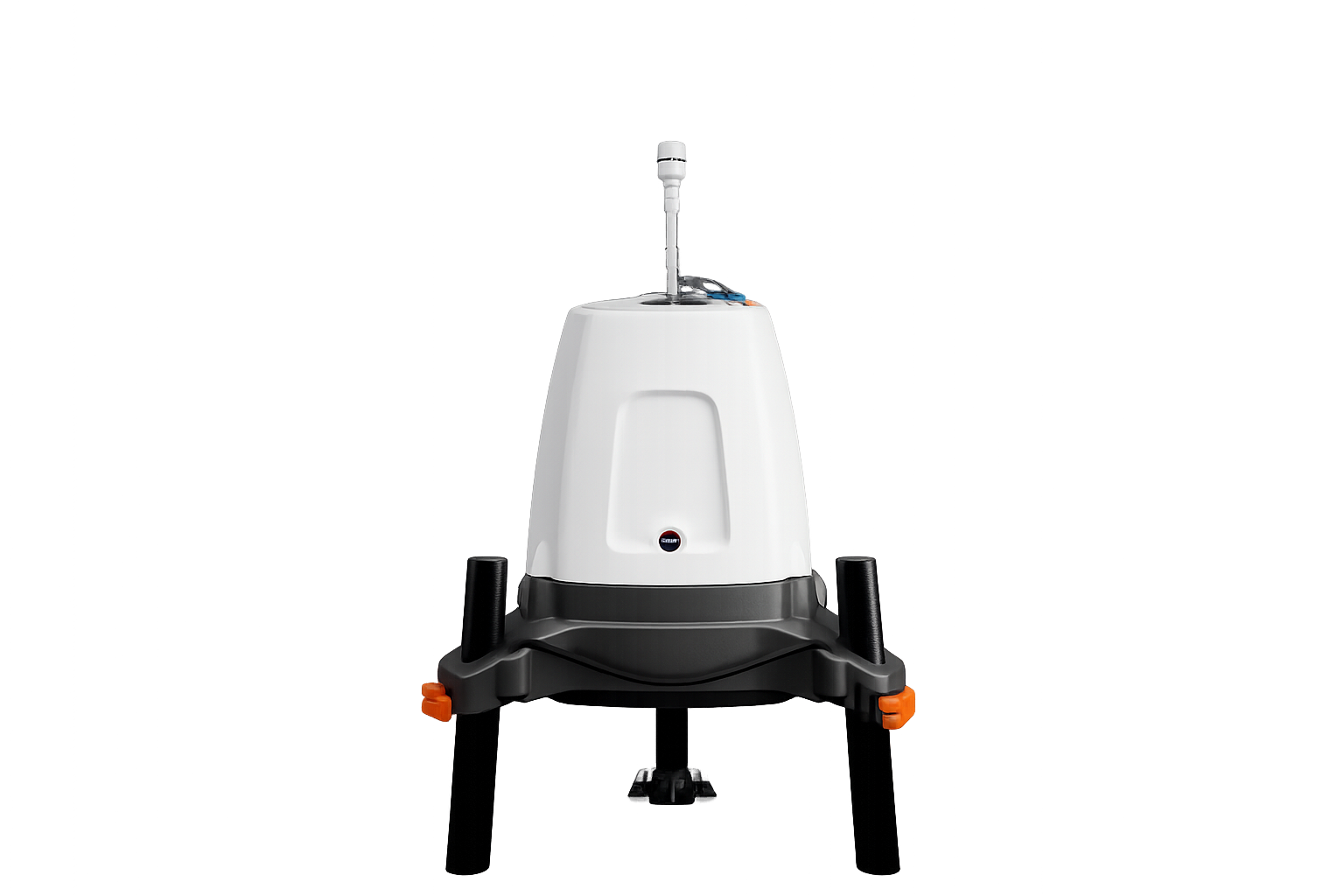
Continuous-wave Doppler LiDAR from ZX Lidars.
Measurement range:
10m – 300m (max 20 heights)
Power consumption:
~44W nominal
Wins speed accuracy:
up to ±0.1 m/s
Wins speed uncertainty:
0.0% (from 21m to 200m)
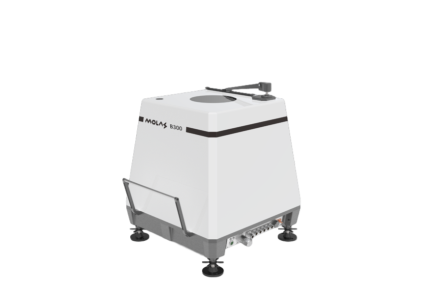
Pulsed Doppler LiDAR from Molas.
Measurement range:
30m – 300m (max 12 heights)
Power consumption:
~60W Nominal
Wins speed accuracy:
up to ±0.1 m/s
Wins speed uncertainty:
2.4% (average from 45m to 121m)
Complete Campaign Solutions
Reliable power supply for remote locations
Weatherproof container / trailer
Solar panels
Battery storage system
Methanol fuel cell (EFOY) backup system
4G/LTE remote communication
LiDAR verification is recommended by industry standards and helps reduce measurement uncertainty.
It is performed by comparing LiDAR measurements with calibrated anemometers installed on a reference meteorological mast.
Anemometer heights: between 80 m and 160 m
Duration: typically 2 to 6 weeks
Performed by an accredited certification body
Additional
Services
Transport to the project site
Positioning and leveling
Configuration of system parameters
Setup of power supply
Setup of communication systems
Initial system checks and commissioning
Detailed installation report.
Daily data checks for availability and plausibility
Early indication of potential issues:
data outages
measurement anomalies
sensor malfunctions
power supply interruptions
Monthly summary reports
Remote diagnostics and troubleshooting
Technical assistance in case of system alarms
Support for power supply or connectivity problems
Coordination of corrective actions if required
If on-site intervention is necessary, a site visit can be arranged in maximum 48h.
Why LiDARbaseLiDARbase was created by wind energy consultants working directly with wind farm development projects.
We've seen what happens when measurements are rushed or poorly documented — LiDARbase was built to make sure that doesn't happen to your project.
Meet our team
-

Stefan Condurache
Lead Consultant
Aerospace EngineerDesign of wind measurement campaign and project management.
-

Mircea Stan
Installation & Operations
System EngineerResponsible for every LiDAR deployment, from transport to commissioning.
-

Daniel Manta
Data & Analysis
Data EngineerFocus on data quality, processing, and IEC-compliant reporting.
Let’s begin the conversation
Whether you are planning a new wind measurement campaign or simply exploring the best approach for your site, we are happy to help.
If you have questions about LiDAR measurements, site conditions, or campaign design, we can discuss the options and help you determine the most practical solution.
If you already have a project in mind, just request a tailored proposal based on your site and measurement requirements.
Share a few details about your site and receive a tailored proposal within 48 hours.